
Walk Reynoldsburg Streets by Address
A Reynoldsburg address search starts by locating the parcel, not by assuming a postal address selects one office. The city reaches into Franklin, Fairfield, and Licking Counties. The City GIS is the useful first pass because its address points connect to layers for all three county systems. Once the county, site address, and parcel or PIN are known, the applicable auditor and recorder can supply a documented trail. A public record may identify a party to a deed or a property owner, but it is not a complete list of people connected to an address.
- Enter the address in City GIS or the relevant county auditor search. Record the county, the site address as printed, and the parcel or PIN.
- Open the county parcel card and keep the physical address apart from any tax or correspondence address. Save the legal description and current transfer clue when shown.
- Use the recorder with party names, an instrument number, or the legal and plat description. Franklin requires this handoff because its recorder does not index property address.
- For a particular, already known name, use Ohio My Voter Information with first name, last name, and the correct county. It confirms a registration path and is not a street roster.
- For an older household clue, compare the historic address or route with a local directory or phone book, then test it against the parcel and recorded documents.
That order avoids a common error: treating the first address-like field as proof of a current household. It also keeps a street-by-street review manageable when a road crosses a county line or a map label changes.
Reynoldsburg GIS Selects County
The City GIS is a locator rather than the final title source. Its data exposes City Address Point fields and separate county layer fields for address, owner-name, and parcel identifiers. Franklin uses address, owner, and parcel fields; Fairfield supplies address, owner, PIN, and parcel identifiers; Licking has street, name, EPIN, Auditor PIN, and formatted-address fields. That structure explains why a Reynoldsburg address search must start with the physical parcel before a request goes to a recorder, court, or board of elections.
The Franklin County Auditor GIS page links Property Search, Parcel Viewer, Open Data, downloads, and Web Reporter for the Franklin portion of Reynoldsburg.
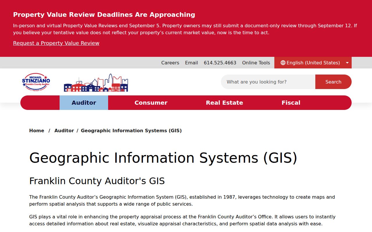
Use that page after the county is known. It provides the county tools that turn a street address into a parcel record, rather than treating the city name as the record custodian.
Note: County selection is the first verification step because one Reynoldsburg postal name reaches three separate auditor, recorder, court, and election systems.
Franklin Address Fields for Reynoldsburg
For the Franklin portion, the Auditor address search is the direct street-directory tool. It separates the street number, direction, street name, and unit instead of accepting a free-form complete address. The Street Name field specifically asks for the name without a suffix. Wildcards are permitted, and the search warns that a request can return up to 500 records. Use a short, accurate street name before widening a search.
| Franklin field | Input | How it works |
|---|---|---|
| Street No | Text | Use the building number when known. |
| Direction | Selection | Choose the directional part only when it belongs to the address. |
| Street Name | Text | Enter the name without a road, avenue, or similar suffix. |
| Unit | Text | Use only when the address has a known unit. |
| Owner or Parcel ID | Text | Owner is last name first; parcel searches allow all or part of an ID without dashes. |
The official Franklin search screen is the source for the field arrangement shown here.
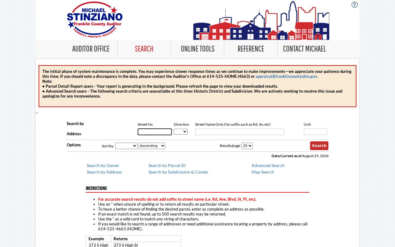
When a result set is too broad, add the street number or unit. Do not use the result limit as a reason to infer that an omitted address has no parcel record.
Reynoldsburg Parcel Card Addresses
Parcel cards use several address concepts, and an address search needs each label intact. Fairfield’s print record separates Location, Deeded Owner Address, and Tax Payer Address. Franklin and Licking also distinguish the site or situs from owner and mailing fields. A site address marks the physical parcel. A tax or mailing field shows where correspondence is directed. A legal description identifies the land in the recorder’s vocabulary. None of those labels should be silently converted into a claim about every person at the address.
- Parcel
- A county’s identified piece of land, usually linked to a parcel number, PIN, or EPIN, which are county property identifiers.
- Situs address
- The physical location assigned to the parcel. It is different from a correspondence address.
- Plat
- A recorded map or subdivision reference used to describe land. It can help connect a parcel card to a deed.
- Criss-cross directory
- A directory arranged by address or street instead of only by name, useful for a dated listing of an older household.
The Licking parcel layer schema documents the assessor, situs, mailing, legal, tax, transfer, and improvement data categories available to that county’s parcel mapping.

Licking’s mapping data is reference material, not an official land survey or legal description. Use recorded plats and deeds when a boundary or title question matters.
Reynoldsburg Street Record Coverage
Different custodians hold different address-keyed evidence. The table separates the main sources used in a Reynoldsburg address-led review from the facts they can support. Start with the county selected through City GIS, then use the record that matches the question. The city’s Building and Code Compliance files are a useful fallback for a narrow, defined request, but research found no general online permit-history index.
| Address record | Keeper | What it can show | Access route |
|---|---|---|---|
| City address points | City GIS | Address location and county-layer switchers | Locator, then county verification |
| Property roll | Correct county Auditor | Parcel, site, owner, legal, value, and transfer facts | County address, owner, or PIN search |
| Recorded instruments | Correct county Recorder | Parties, dates, instrument, legal, and plat references | Party, legal, or instrument search |
| Tax record | County Treasurer | Bill and correspondence route | County tax channel |
| Registration check | Correct county BOE | Public registration and precinct facts for a matching name | State lookup or lawful county procedure |
| Permit or code file | Reynoldsburg Building and Code | Defined project, application, or inspection record | Specific request or counter inquiry |
A parcel number and legal description are the durable links between an address search and a deed chain. The street name alone may not be enough for a recorder search, especially in Franklin County.
Reynoldsburg Street Segments on GIS
A map can clarify the parcel sequence along a segment without turning it into a list of household members. The Franklin Parcel Viewer offers By Shape, By Value, and By Spatial. For a short stretch of road, select a base parcel, choose By Spatial, enter a distance, apply the buffer, then choose parcels inside or intersecting the buffer. The resulting selection can be exported to CSV and individual mapped parcels can lead back to property records.
In Licking County, the parcel viewer accepts an abbreviated address, an owner in LastName, FirstName form, or an Auditor PIN. It also has a feet-based buffer, report output, and CSV export. Fairfield’s audited property record supplies address, parcel, map, sales, owner, taxpayer, and legal fields, but this research did not confirm an equivalent public buffer control. Treat each county’s tool as its own system.
Note: A spatial selection identifies nearby parcels, not the people connected with every building on those parcels.
Reynoldsburg Deed Chain Clues
After the parcel card provides a legal description or a current transfer clue, use the appropriate recorder. The Franklin Recorder Public Records Search provides a Cloud Search and legacy gateway, a recorded-date limiter, and book, volume, or page retrieval. Its recording FAQ says property address is not indexed, so a street search should be converted to parcel, legal, party, or instrument clues before relying on recorder results.
Read a current deed for the party roles, legal description, prior-instrument reference, and recorded date. Then use the prior grantor as a possible grantee in the preceding transaction, checking the parcel and legal description at every turn. Fairfield’s county hub routes land records separately from the auditor; Licking’s Recorder DTS public access has an online path, while older material may require the Recorder or Records & Archives counter. An absent online hit is not proof that no instrument exists.
Reynoldsburg Permit Records by Address
City material can add a dated construction or code clue after the parcel has been identified. Reynoldsburg’s residential permit application uses a certified street address, parcel number, lot number, city or township, ZIP, and county, along with project and party fields. The form indicates why a focused request can be useful: permit records may contain the application date, permit number, project description, area, work type, owner or applicant fields, and inspection-related information.
There is no broad city permit index available online in the research. Use the City public-records channel or the counter with a narrow description that gives the address, parcel if known, date range, and record type. Ohio’s Public Records Act, also called the Ohio Sunshine Law, supports requests for nonexempt records but does not turn an open-ended address inquiry into a title search.
Reynoldsburg Historic Street Translation
Older street research needs a dated source and a cautious translation. The Reynoldsburg-Truro Historical Society identifies a specific change in its 1939 local directory: historic Broad Street is now Broadwyn. That is a useful address clue, not evidence of a citywide renumbering rule. The 1872 Franklin County atlas also labels Main or National Road, Broad, South, Ash, Jackson, and Lancaster Streets, plus lots and landholders.
Use the atlas and a legal or plat description to bridge old and current forms case by case. No comprehensive Reynoldsburg renumbering or renaming crosswalk was found. For deeper reading of the dated listings themselves, the Reynoldsburg Directory Book keeps the historical collection separate from this address-led trail.
Note: A historic street label can guide a search, but parcel history and recorded legal descriptions decide whether two address forms refer to the same land.
Limits of Reynoldsburg Street Directory
An address-led record review can document limited public facts. It cannot establish a complete household, a private delivery record, utility account information, motor-vehicle data, or a protected address. Ohio Safe at Home participants may use substitute addresses in public records. Protected election fields and records subject to redaction also remain outside ordinary public access. A property owner, deed party, or tax correspondence address should be described only as the record labels it.
For a correction or a record not available online, contact the office that maintains that particular parcel, instrument, or municipal file. Verify a date, party role, parcel, and legal description before acting on a result. The limits matter most where one street crosses a county boundary or an old street form leads to a different modern map label.
Lawful use. Use Reynoldsburg address records for personal, lawful research. Ohio law addresses stalking and telecommunications harassment, and protected address information must not be sought or used to target a person.